Topcon Positioning Systems and Proceq, a Screening Eagle Company, have announced a collaboration focused on expanding the use of advanced subsurface intelligence technologies across Europe, the Middle East, and Africa (EMEA). The partnership will combine Proceq’s ground penetrating radar (GPR) systems with Topcon’s global navigation satellite system (GNSS) solutions and mass-data workflow software to support infrastructure and construction applications.
The collaboration is designed to connect subsurface information with accurate spatial positioning, giving construction and infrastructure professionals a more integrated approach to collecting, managing, and analyzing field data. By bringing together GPR technology and positioning solutions, the companies aim to help professionals better understand underground conditions and incorporate that information into digital project workflows.
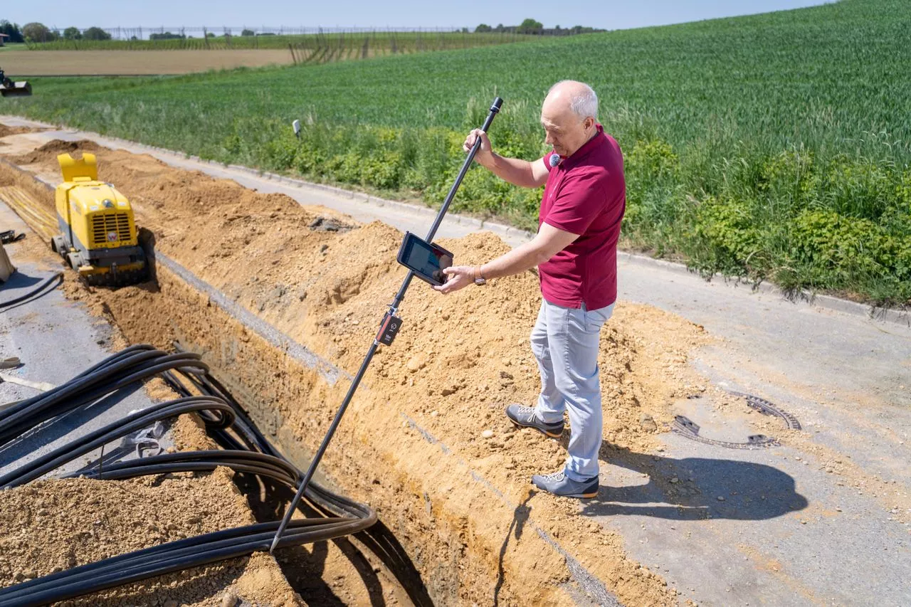
Ground penetrating radar is increasingly used in construction and infrastructure projects to investigate conditions beneath the surface without requiring extensive excavation. GPR systems can help identify underground features and provide information that can support activities such as utility mapping, structural investigations, road assessments, and other subsurface applications.
Topcon’s GNSS technology provides precise positioning capabilities, while its Topnet Live correction services are designed to support accurate location data in the field. The collaboration will also incorporate Topcon’s Collage Web mass-data workflow software, creating a connection between subsurface data and spatial information.
“Proceq provides ground penetrating radar technology, and we are pleased to collaborate with them to deliver advanced, compatible technologies for industry professionals across EMEA,” said Ron Oberlander, head of the Topcon Geomatics and Construction Platforms. “By combining Proceq’s GPR capabilities with Topcon’s GNSS technology, Topnet Live correction services, and Collage Web mass-data workflow software, we are connecting subsurface information with precise spatial context to support more informed analysis and decision-making.”
One of the key objectives of the collaboration is to improve how subsurface information is collected and connected with project data. Construction and infrastructure projects often require professionals to understand both what is visible above ground and what exists beneath the surface.
Accurate positioning can provide important context for GPR measurements. When subsurface observations are linked to precise geographic coordinates, project teams can more effectively organize information and incorporate it into broader digital workflows.
The combination of Proceq’s GPR technology and Topcon’s GNSS solutions is intended to support this approach. Topnet Live correction services can contribute to positioning accuracy, while Collage Web is designed to facilitate the management and processing of large volumes of captured project data.
This integration can be particularly relevant for projects involving roads, bridges, utilities, buildings, and other infrastructure where knowledge of underground conditions is an important part of planning and execution.
The partnership also reflects a broader industry shift toward digital construction and infrastructure management. As project teams increasingly adopt connected technologies, the ability to collect accurate field information and integrate multiple data sources is becoming an important part of project workflows.
Subsurface intelligence can play a significant role in this transition. Underground information can help construction professionals assess existing conditions, plan work, and reduce uncertainty before excavation or other physical activities begin.
Alexandre Novo, senior vice president and head of the Business Unit Subsurface Insights GPR at Proceq, said the collaboration with Topcon is an important element of the company’s growth strategy for subsurface intelligence.
“Collaborating with Topcon is a key element of our growth strategy for subsurface intelligence,” said Novo. “Together, we are combining Topcon’s global leadership in positioning and geomatics with Proceq’s advanced GPR technology to expand, unlock new markets and applications, and accelerate the digitalization of infrastructure worldwide.”
The companies expect the collaboration to help expand access to subsurface intelligence applications and create additional opportunities for professionals working across infrastructure and construction markets.
The EMEA region represents a diverse market for construction, surveying, infrastructure development, and asset management. Projects across the region can involve complex existing environments where accurate information about underground conditions is essential.
By combining GPR, GNSS positioning, correction services, and mass-data workflows, the collaboration is intended to provide professionals with tools that can support data collection and analysis across different project environments.
For surveyors, contractors, engineers, and infrastructure specialists, integrating subsurface measurements with geographic positioning can make field information easier to organize and use. Digital workflows can also help project teams move from field data collection toward analysis and documentation more efficiently.
The collaboration may also support the growing demand for technologies that can contribute to safer and more informed construction practices. Having better information about underground conditions can help teams plan activities before physical work begins and support decision-making throughout the project lifecycle.
Topcon and Proceq will showcase the technologies associated with the collaboration at INTERGEO 2026, the trade fair focused on geodesy, geoinformation, and land management.
The event is being held in Munich, Germany, from September 15–17, 2026, bringing together professionals and technology providers from surveying, geospatial information, construction, and related industries.
The showcase will provide an opportunity for industry professionals to learn more about the combination of Proceq’s GPR systems and Topcon’s positioning and data-management technologies. Demonstrating the integrated capabilities at an industry event also highlights the companies’ focus on connecting field measurement technologies with digital workflows.
As construction and infrastructure organizations continue to adopt digital tools, integrated data collection is becoming increasingly important. Technologies that connect positioning, subsurface investigation, and data management can provide project teams with a more comprehensive view of existing conditions.
The Topcon and Proceq collaboration represents an effort to bring these capabilities together for professionals across EMEA. By combining GPR technology with GNSS positioning, correction services, and mass-data workflow software, the companies aim to support more connected subsurface intelligence applications and contribute to the continued digitalization of construction and infrastructure projects.
Source Link:https://www.businesswire.com/